NATURE
Why Is the Eye of a Hurricane Calm?
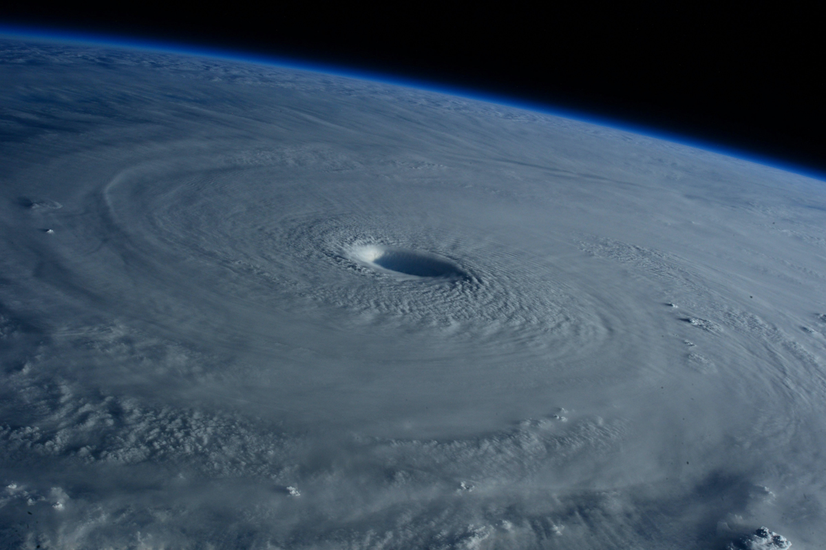

“The eye of the storm” is a phrase commonly used to describe an unnerving sense of calm in the middle of a stretch of chaos. It means more trouble is coming — not that the worst is over — and it’s borrowed from meteorology.
At the center of a real hurricane, known as the “eye,” the winds drop, the rain stops, and the sky can clear enough to show blue. It’s a genuinely peaceful lull wedged between the two violent halves of a powerful storm.
It may seem strange that the middle of a hurricane is its calmest part, but once you understand the physics of the storm, it starts to make sense.
Why Eyes Form in Skies
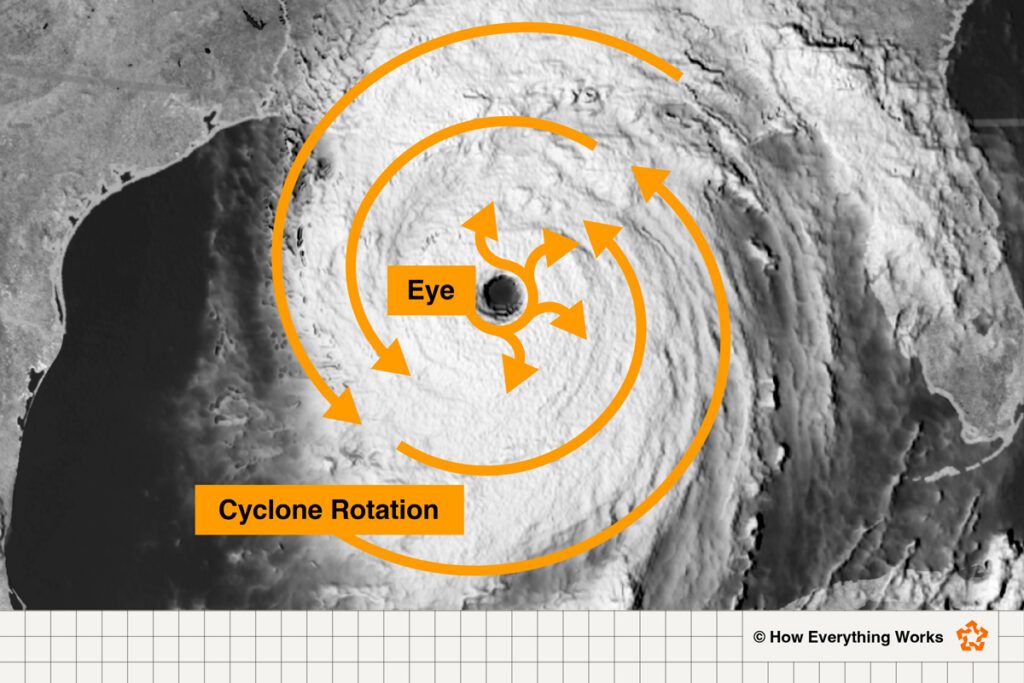
A hurricane spins around a center of very low air pressure (the big “L” on a TV weather map). When it’s large enough, you can often see the eye in the middle of an aerial view of a hurricane, resembling the hole at the heart of a pinwheel.
Wrapped around that center is what’s called the “eyewall,” a ring of severe weather where the heaviest rain and fastest winds live. Sustained winds can easily top 100 mph in a strong storm, and get much faster in the worst ones.
The eye and eyewall are inextricably linked by the physics of the storm. Air speeds up as it rushes inward toward the low-pressure core, the same way a spinning figure skater whirls faster when he pulls his arms in. (Scientists call this the conservation of angular momentum.) That’s why the winds are strongest near the middle, at the eyewall.
Here’s the twist: The faster that air spins, the harder it gets flung back upward and outward (think of a spinning carnival ride like the Gravitron — the faster it whirls, the harder you’re pressed against the wall). Right at the eyewall, that outward push roughly balances the inward pull toward the center, making it so that the racing air can’t quite cross through that eyewall.
So instead of filling the middle, air circles around it, carving out a relatively still pocket. Smaller eyes concentrate the force of a storm and make for more intense eyewalls and stronger hurricanes overall. While the average eye ranges between 20 and 40 miles wide, 2005’s Hurricane Wilma — the most intense Atlantic hurricane in history — had an eye that was only 2.3 miles across.
Clearing the Air
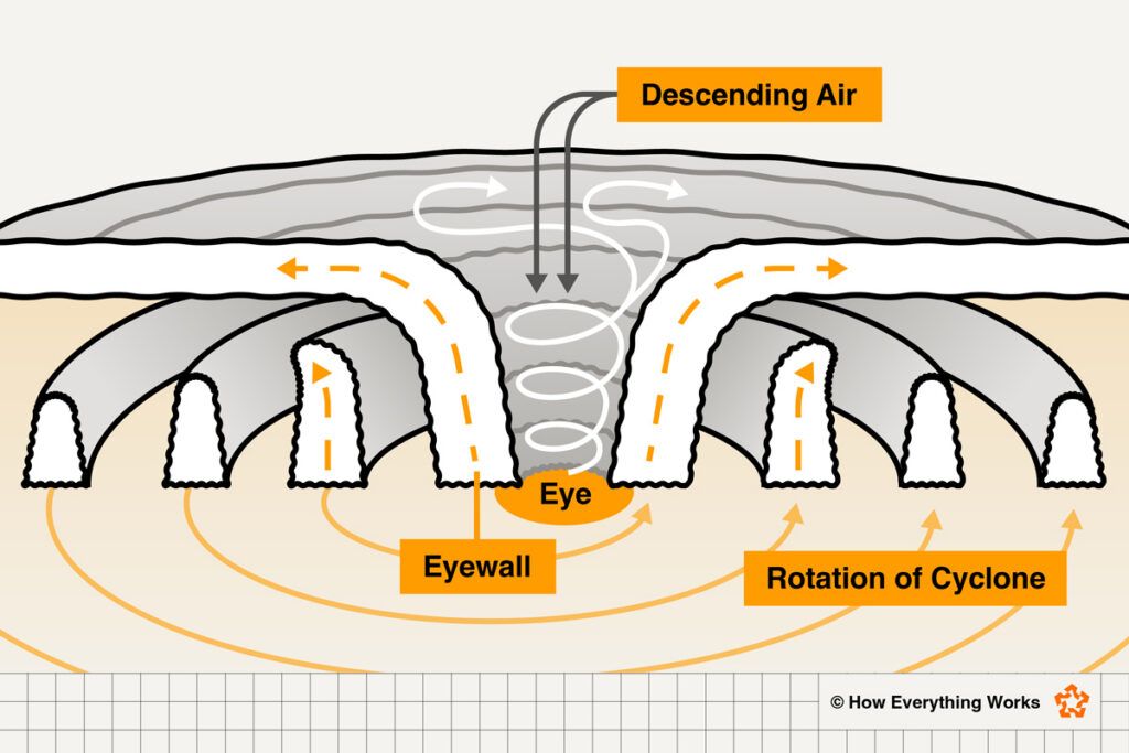
That pocket doesn’t stay empty, though. It fills from a different direction: Air sinks straight down into the eye from high above, compressing and warming as it falls. Warm air holds onto its moisture as vapor. This is the opposite of how clouds form, since they occur when air rises and cools.
That’s why the eye has clear skies. And because this air is easing downward rather than racing sideways, the winds stay gentle, usually under 15 mph, even as the eyewall roars by just a few miles away. Since pressure is lowest at the eye, you may even feel your ears pop as you would on an airplane.
It’s worth noting that scientists still don’t fully understand every detail of how the eye forms and holds its shape. What they do know is that the calm is a trap. Hurricanes don’t stay in place — they travel, tracing a path of destruction. Once the eye passes overhead, the eyewall comes back — this time from the opposite direction. People who head outside thinking the storm is over can be caught off guard.
Not only isn’t it over, but things are likely to turn very quickly, and you’ll soon experience some of the worst the storm has to offer. This is why the National Weather Service warns you to stay put until there’s an official all-clear.
A hurricane’s winds spin so fast that they fling air outward, keeping it from reaching the very center — so the storm’s strongest winds circle the middle rather than fill it. Meanwhile, air sinks into that center from above, warming and drying as it goes and clearing out the clouds. The result is the eye: a calm, often-clear patch surrounded by the storm’s most violent weather. Because hurricanes move, people in the eye likely pass through the destructive eyewall twice — once as the storm is coming and again as it is going.
Short Answer